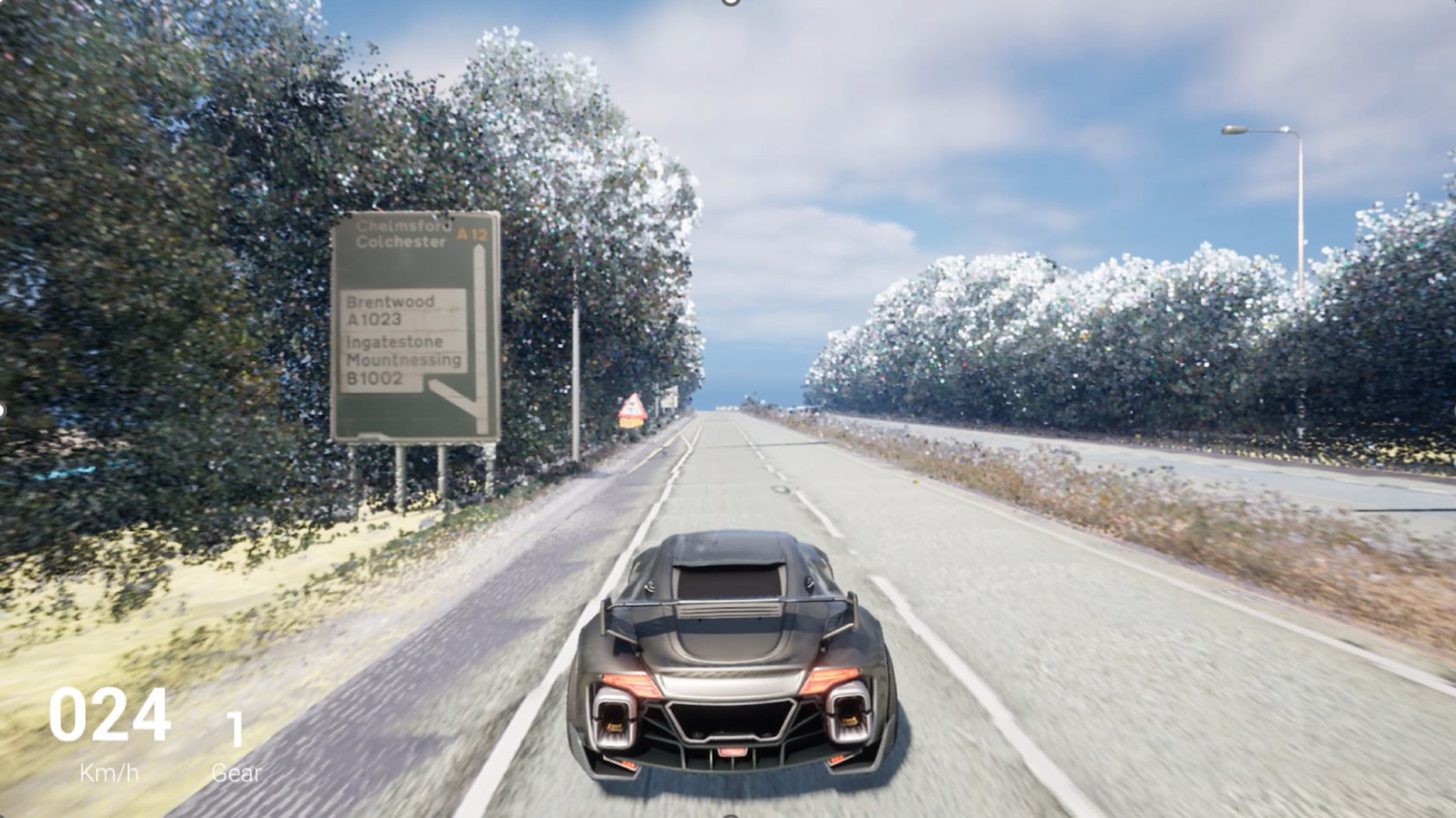
Costain and Cambridge University researchers have made freely available a significant dataset that should help kickstart the development of digital twins for roads.
The CAMHighways dataset, drawn from 42.8km of mobile mapping data of the A11, A12 and A14, consists of:
- textured meshes for road assets (including the pavement, traffic signs, and road furniture);
- segmented and classified point clouds;
- orthomosaics generated from pavement images;
- defect label annotations and shapefiles; and
- ground penetrating radar (GPR) point clouds.
All the data types are georeferenced to the British National Grid and can be integrated into game engines and/or GIS software.
Register for free or sign in to continue reading
This is not a paywall. Registration allows us to enhance your experience across Construction Management and ensure we deliver you quality editorial content.
Registering also means you can manage your own CPDs, comments, newsletter sign-ups and privacy settings.
Story for CM Digital? Get in touch via email:
[email protected]