Construction leads the world in its use of geospatial technology – and policymakers looking to increase its use should learn from the sector, says Cesar Mendoza from Topcon Positioning Systems.
Geospatial technology is on a sharp upward trajectory. It’s becoming both more capable and more accessible for a huge range of new markets and applications. Policymakers and leaders from various industries are beginning to wake up to the opportunity offered by precision technology to build smarter cities, transport networks and even consumer products.
In the UK, the adoption of this technology is being encouraged by the government’s Geospatial Strategy 2030, which seeks to unlock the power of location for the UK economy over the next five years.
It’s a real statement of intent that forecasts a geospatial ecosystem to support a diverse range of industries, from e-scooters to large-scale public infrastructure. As they deliver the strategy, policymakers and industry leaders should look to, and learn from, the construction sector, which has already established a healthy, productive and innovative geospatial footprint.
Site-wide support
Global navigation satellite systems (GNSS) aren’t new technology, having offered centimetre-level accuracy on construction projects for more than two decades. But with the rapid evolution of positioning technology, the arrival of new chipsets and more open GNSS signals – in the context of an increasingly competitive market – geospatial tech is now truly revolutionising the sector.
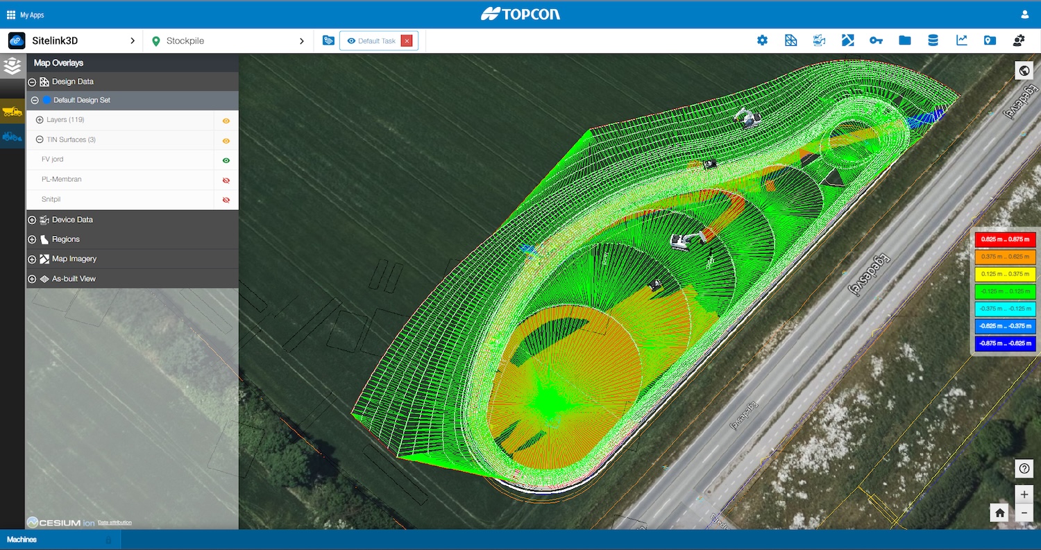
As the technology has developed, so too has the sector’s understanding of how to maximise its benefits. Recent updates, including consistent integration of real-time kinematic (RTK) technology into GNSS systems, have addressed previous limitations, such as a lack of direct satellite visibility. Construction businesses can now rely on geospatial-grade accuracy in GNSS-denied environments with the help of correction services such as Topcon’s Topnet Live, which delivers the most accurate data from all the sources available from a specific position.
As governments and large-scale industries size up geospatial technology for mass market applications, they’ll need to make it work in varied environments: cities, tunnels and forests, for example. They should look to the technologies and digital workflows used in construction for evidence of how a thriving geospatial ecosystem is boosting efficiency and accuracy in a complex sector.
A digital reality
Powerful, intuitive and portable reality capture technologies are making it easier to model new and existing assets quickly, easily and comprehensively. BIM has become the norm on urban projects in particular, and modelling platforms such as ClearEdge3D EdgeWise automate a traditionally cumbersome transition from initial scan-to-BIM components, which can be exported to design platforms like Revit, PDMS and Plant 3D. Leaps forward in individual processes will enable a future in which whole communities are supported by detailed digital twins.
The value of BIM and reality capture in the built environment increases exponentially with broader adoption, and that doesn’t just require a streamlined workflow, but also reality capture tools with a near-flat learning curve. This means bringing the technology to devices that all professionals have in their pockets. Topcon’s latest partnership with global photogrammetry leader Pix4D expands access to high-precision positioning and 3D mapping technologies across a range of industries to smartphones.
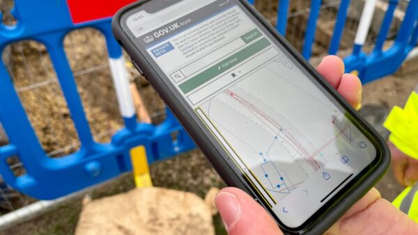
Governments aren’t waiting to leverage advances in geospatial and reality capture technology to make their cities smarter – one groundbreaking initiative is the National Underground Asset Register (NUAR). This digital map of underground pipes and cables will be available to workers and project managers as a vital resource in the planning and construction of new buildings and infrastructure. Portable, intuitive and precise positioning technology will be instrumental in establishing large-scale public resources such as the NUAR, and policymakers looking to implement it should look to construction as a strong example of how the technology is already driving significant efficiencies.
Mass market impact
As geospatial technology hits the mass market, and the consumer electronics and transport sectors in particular, operators will have to take this huge amount of GNSS data collection and processing in their stride. The arrival of AI-assisted software stacks has the potential to be a game-changer here, not just for data processing but also for data protection, detecting anomalies and spoofing or jamming attempts as they occur.
The vision set out in the Geospatial Strategy is for an Internet-of-Everything, where precision positioning technology supports all manner of business operations and is at consumers’ fingertips. Again, construction can be the petri dish for this, as an industry where geospatial has been integrated at every step in digital workflows and which is already reaping the rewards.
From construction to the world
Geospatial technology is going mainstream – rapid development has brought new opportunities almost everywhere, from consumer electronics to large-scale public infrastructure. Governments and a range of industries are looking to capitalise, and many have already made significant progress. But as they work to bring cutting-edge positioning into their operations, I’d recommend a visit to a construction site for a taste of what this technology can do when it’s implemented right.


