Esri UK GIS users can use an assessment tool to help them meet the government’s biodiversity net gain (BNG) regulations for major developments.
The BNG regulations came into force earlier this year. They require developers to provide at least 110% of the biodiversity value found on the site prior to their development. BNG can be delivered either fully or in part through onsite habitat, offsite habitat or, as a last resort, the purchase of statutory biodiversity credits.
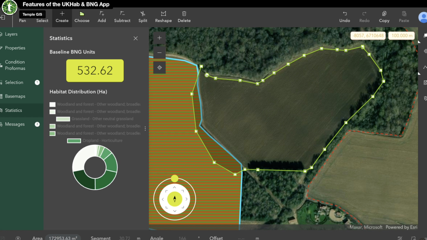
The UKHab and BNG Survey App is meant to simplify the processes involved in BNG assessments. According to Esri UK, the software streamlines the workflow from field data collection to in-office assessment and provides a real-time BNG score.
The app also enables the use of existing UKHab surveys and conversion to BNG surveys. This means users can take advantage of their current ecological processes and comply with the new legislation faster and more cost-effectively.
The app was developed by Esri UK partner, Temple, an environment, planning and sustainability consultancy. Temple’s customers include Network Rail, Transport for London, and the Government of Jersey.
Additional functionality in the tool will soon include scenario modelling, to make the comparison of potential designs more accessible and financial differences more quantifiable. Future plans include apps aimed at specific sectors and their roles in BNG, including rural landowners, local government planning authorities and land developers.
Craig Evenden, head of AEC at Esri UK, added: “Already widely used in ecology and conservation, GIS applications help users understand the state of biodiversity and reveal insights into complex environmental challenges. Temple’s new application is a robust offering, building on Esri’s technology so BNG can be both determined and delivered, ensuring environmental sustainability and compliance with the new legislation.”
Don’t miss out on BIM and digital construction news: sign up to receive the BIMplus newsletter.